I have never been satisfied with my approach to urban adventuring, so when the middle school players in my Dwimmermount campaign announced their intent to visit the city-state of Adamas, I felt the push to try something new.
 |
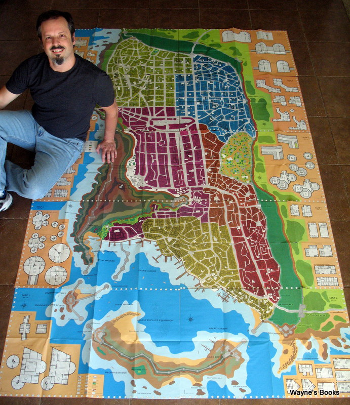
| Ultimately, the front cover was the best part of this misnamed monolith |
The players never really learned their way around ...
player: "What's number 85?"
me: "Well, it's um ... [flip, flip] ... a candle shop."
player: "I don't want any. What's number 62?"
me: "Well, um ..."
Ugh.
 |
| There's Wayne, from Wayne's Books posing with a copy. |
One solution was to simply label the map, but that still fell a bit flat for me, perhaps because the names alone still didn't empower the players to make informed choices.
Recently, however, I read Roger G-S's musings on a Street Guide Without Streets. Mphs.Steve's comment got me thinking about what old maps of cities actually look like and how I can offer my players a shorthand description of exactly what they can do in various districts.
 |
| Some historical maps, like this one of Jerusalem, create a feel for the place without naming or even picturing each street. |
Here's what I've worked out so far:
- a simple sketch of the city to establish a feeling for the place
- each district gets a card, placed directly on the map
- each district card lists several locations and what can be purchased, learned, or sold there (e.g. "Jasper the Alchemist - substances identified, select potions at 500 gp / spell level")
- each time a character enters a district, I roll a D6 for encounters (random encounter on a 1)
- each district has its own random encounter card (color-coded for fast sorting)
 |
| Here's what it looked like with cards in place. |
The first run went reasonably well, with the players focusing on where they wanted to go and telling me their next move.
"I want to go to the market stalls."
"I'm going to the Shrine to St. Tyche to ask about a healing spell."
My job became as simple as rolling for street encounters and animating key NPCs as they visited their chosen locations. No flipping around through a city sourcebook, and no delays at the table!
One problem was that the district card text was too small for each player to see from their seats with ease. Perhaps each location in a district should get its own card and the players can simply sort through the deck when visiting that part of the city.
Finally, it was clear that miniatures would come in handy when tracking movement from one district to another.


No comments:
Post a Comment